October 15-16th
I have lived overseas long enough, and I like to think that my geography is pretty good, but I gotta admit, the Polynesian area is my least traveled area. When we arrived in Micronesia, my lack of understanding of the region was apparent. I wasn’t sure if Yap was a country or if it was Micronesia. I was so confused.
Just in case you are lacking in knowledge of the area, too, let me share a few things I’ve learned. The Federated States of Micronesia is an independent islands country that consists of four states. Yap is one of those states, and consists of four main islands. Between all four states, there are 607 islands, and in the Micronesia region, there are 2000 islands. Many are small and uninhabited.
The state of Yap has a main island with the capital of Colonia, and that is where we were anchored. The population is about 6000, and half of them are on the main island. You can drive from one end of the island to another in about half an hour from the capital. The maximum speed on the roads here is 20 mph or 40kmph.
Needless to say, it’s quite small. Also, the islands are privately owned, in that all of the land, including the beaches and waters, is owned by its citizens. So if someone wants to go swimming or snorkeling, or hiking, you must ask permission first. Every chicken or rooster that is running wild belongs to someone. Every fruit tree belongs to a family. Because of this, one of our residents contacted the only travel company on the island to arrange tours on the days that we were there.
I was late to the game but managed to book two tours. One was a land tour on our first day there, and the second was a kayaking trip on our final day.
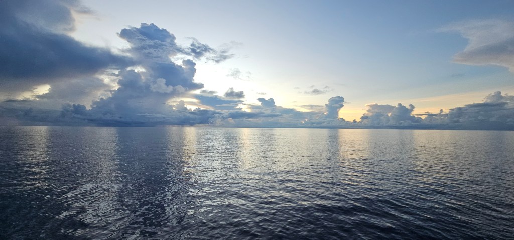
My biggest concern as we approached the area after 3 sea days was that our ship might not be able to dock, and we would have to anchor and tender in. Our chances of being able to tender in would have been slim to none. The Odyssey’s measurements were technically above the length that the port takes in. It was decided that the pilot would make the decision on the morning of.
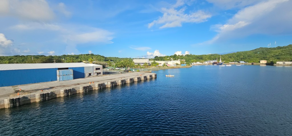
Everything was in our favor, and we were able to dock at the pier. This was great, we thought all of our tours were ago, although perhaps a little later start than we had originally planned, but customs and immigration took longer than it has at any other port.
We were finally able to leave the ship and walk to the tour agency, which was about five minutes away. Our tour was supposed to leave at 8, with them leaving at 10:30. instead of a four-hour land tour, I ended up on a two-hour tour.
I’m actually kinda glad that it ended up being just a two-hour tour. I’m not very good at large group tours. I don’t like that many people, and their slow behaviors often irritate me. We had three main stops on our tour.
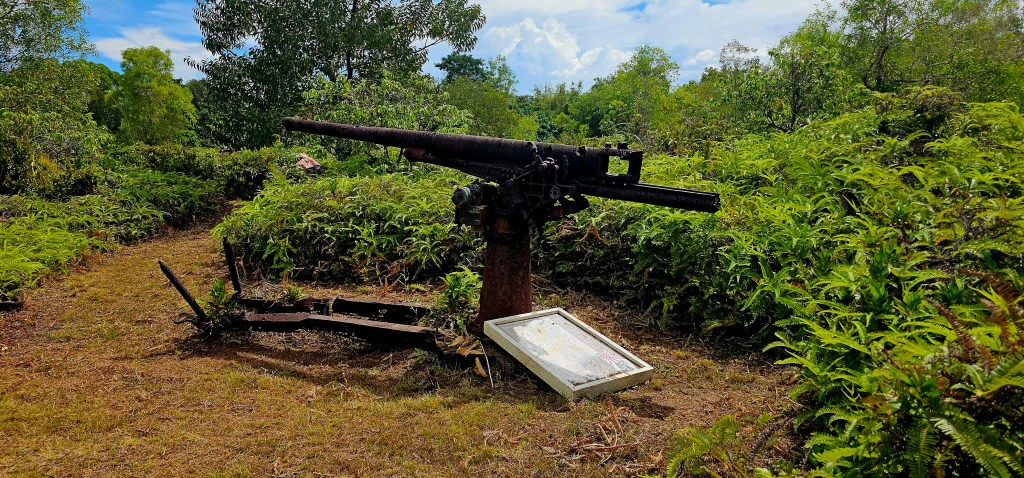
The first was looking at some World War II remnants on the island. In several spots around the island, you can see where the Japanese who were occupying the island at the time had set up a base. After Pearl Harbor, the Americans eventually came and bombed the island, focusing on these Japanese installations. Once the Japanese left or retreated from the area, these bombed-out barracks were just left in the jungle and on the land.
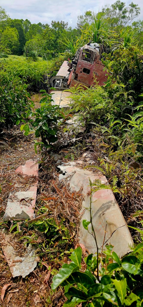
We went and saw some Zero fighter remains, as well as a air missile gun.
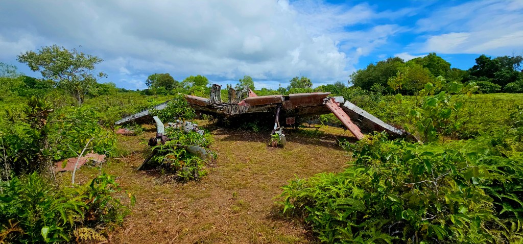
One thing to mention was that in each of these spots, we needed to walk a few hundred meters in order to see them through some pretty muddy ground.
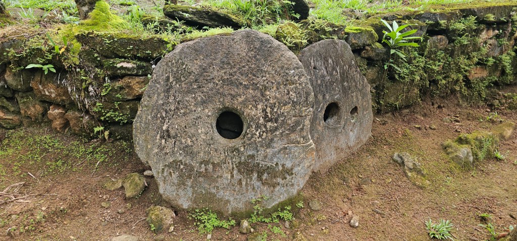
Our second stop is the highlight of the tour and what the island is most famous for, Stone money. A stone money bank is an area where these giant stone circles have been deposited, like in a bank. Nowadays, they do not have a monetary value, but each family owns certain stones and they tell the story of their history. The stones were actually brought from Palau and could take four or five years to carve and transport.
These stones vary in size, with some being taller than me. They are circular in shape with a hollow centre or a hole in the middle, like a doughnut, in order to be carried. The better story or history that came attached to the stone increased the value to the people. Nowadays, no new stones are being made or brought to the island.

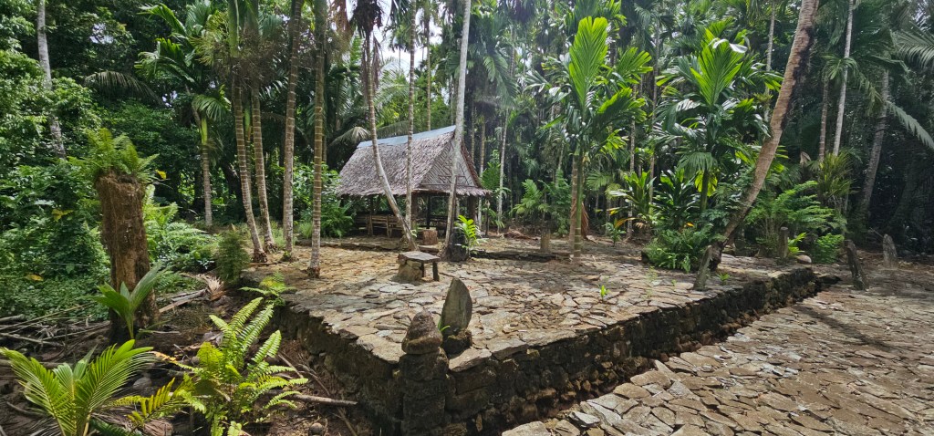
Our final main stop was to what’s called Galas Ngarly, or the Men’s House. These are buildings that have been constructed out of the local trees along the coast where men would hang out or sleep before fishing or other manly endeavors. It’s also where young boys would go to learn how to be good fishermen. Women have always been forbidden to visit these houses, and even today, only female tourists can go into them; the local women stay away. Now this might sound chauvinistic, but the walls do not go from ceiling to floor, so any person can see in. It does not keep good secrets.

When we drove past our driver’s, Richard’s, village, he stopped to let us take a picture of the catholic church. This is the main religion of the island. The graveyards are near the churches and all of the headstones and grave sites are richly decorated. They look like a party’s happening on the graves.

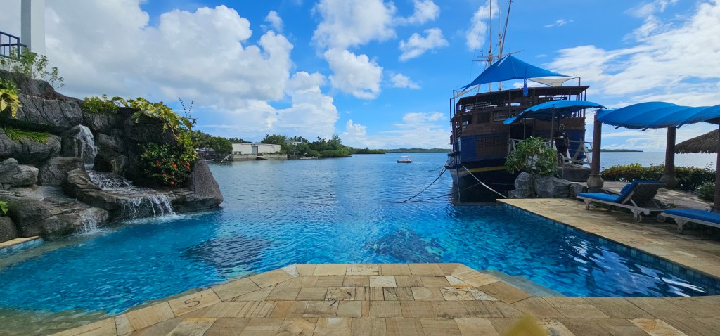
After the land tour, I went to the local microbrewery and restaurant on a boat. Here I tried the two local craft beers: a pale pilsner-type beer, and then a what they called dark beer.
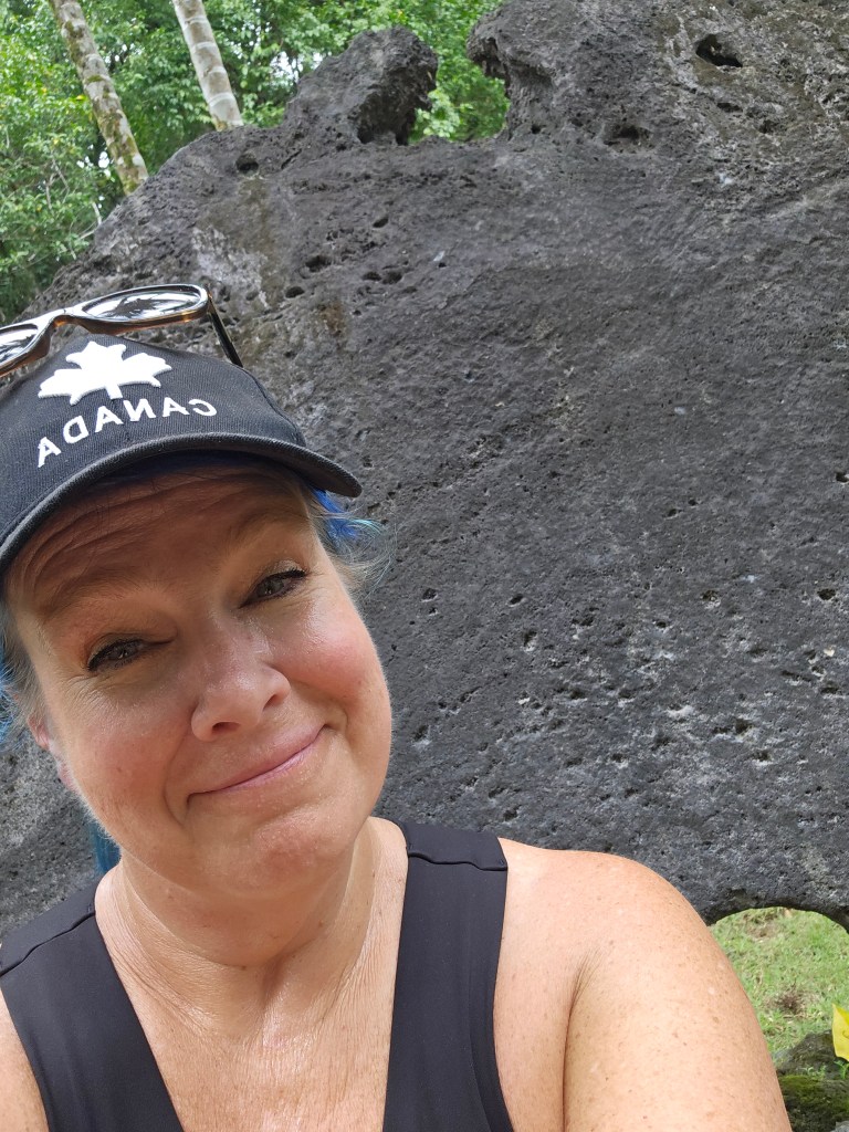
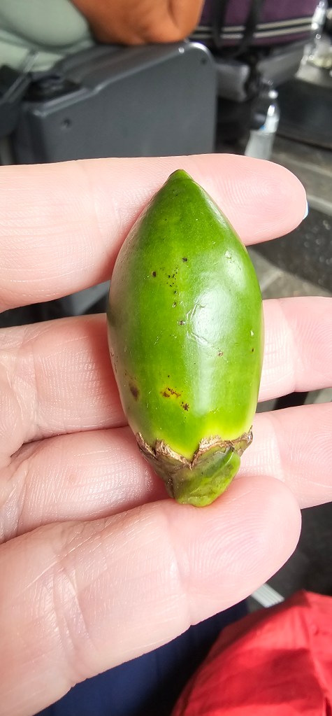
The people I met walking around, and when I went into the stores, were all super friendly and excited to see me. It was definitely small-town vibes with cars waving at you as they went past and conversation stopping when you entered a room until you said hello. My blue hair was certainly ahead amongst the locals. One thing you will notice here is that most of the adults and many of the young teenagers have red mouths. This comes from the addictive chewing of the betel nut. Is it as addictive as smoking, and everyone does it.
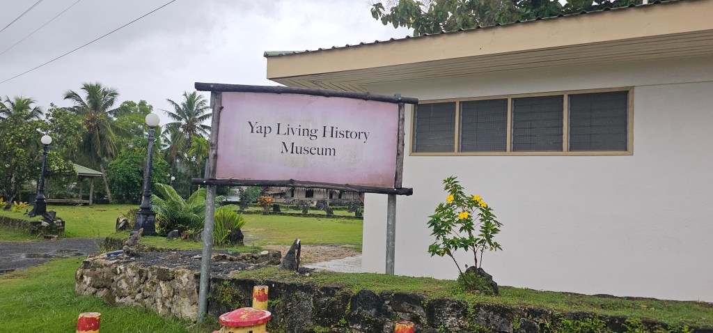
On day two, I woke up to rain, and the forecast was not giving me much hope. Paul and I went out for a quick walk to look at the Living History Museum. This museum has a village set up of buildings that you might typically see in each of the villages. It includes a common area, a house, a men’s house, and two other buildings. Several dogs were hanging out in these houses, trying to stay out of the rain.
We also wandered across a bridge to see the other side of town. Spoiler alert: There wasn’t much there.
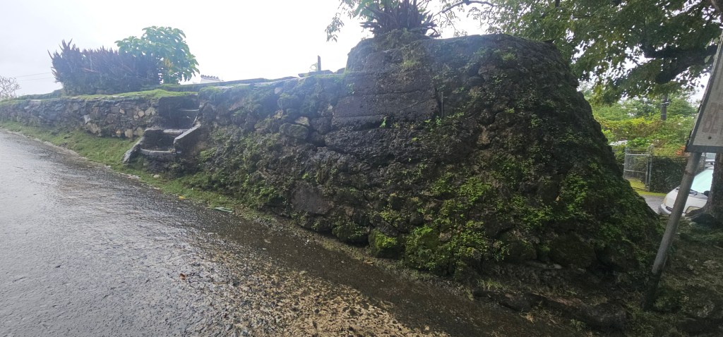
On our way back to the ship, we could see that there was a Spanish Fort on Google Maps, so we went to have a look. There is not much of a Fort left except the base of the walls on which a government building has been built.
Luckily for me, the rain stopped in the afternoon, and I was able to go on my kayaking adventure. Only three of us took the chance. You could tell they were expecting more, as we had a tour guide and two helpers, so one for each of us.
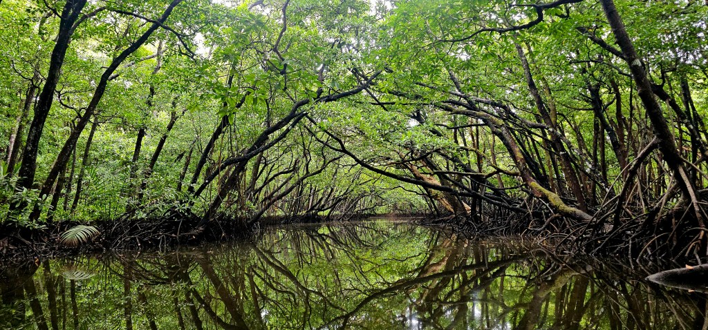
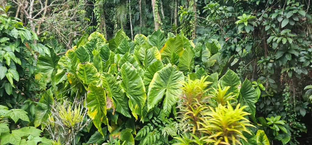
We went to the other side of the island, where we got in our kayaks and traveled through some mangroves. The overcast skies were actually perfect, so that we didn’t get early hot or burnt in the sun. The mangroves were beautiful with calm waters and the sounds of birds chirping. My only complaint is that the mosquitoes kept trying to make me a tasty treat.
It was a great two days in a new country for me. I highly recommend a stop here if you are in the area.

Leave a comment